Washington, D.C. forecast: foggy Friday morning commute, persistent clouds later, and cooler temperatures overnight
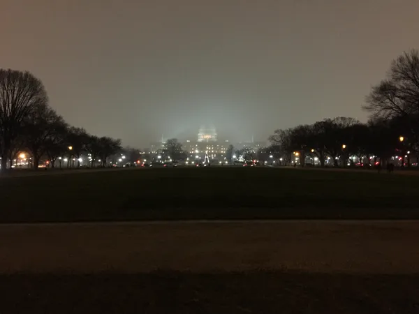
Low visibility early, limited improvement in the afternoon
Washington, D.C., is expected to begin Friday with areas of fog that may reduce visibility during the morning commute, followed by a mostly cloudy afternoon. The fog is forecast to lift gradually as the day progresses, but cloud cover is likely to remain widespread for much of the region.
Temperatures are projected to turn milder by later in the day, with readings approaching about 60 degrees. Conditions are expected to cool back down Friday night, with temperatures dropping to around 40 degrees in the metro area.
What residents should watch for during the commute
Fog can create quickly changing driving conditions, especially near rivers and low-lying areas across the District, Northern Virginia, and suburban Maryland. When fog is present, visibility can vary sharply from block to block, which can affect highways, bridges, and approaches to major interchanges.
- Allow extra travel time during the morning peak.
- Use low-beam headlights in fog; high beams can worsen glare.
- Increase following distance and be prepared for sudden slowdowns.
Afternoon outlook: clouds linger, but some drying is possible
After the fog diminishes, the afternoon is expected to remain mainly cloudy. While breaks in the overcast are possible, the dominant theme is cloud cover rather than extended sunshine. Forecast guidance points to the potential for a quieter stretch later in the day compared with the morning, though conditions may vary across the wider region.
Looking ahead: weekend trend leans cooler, with attention on Sunday
For Saturday, the regional pattern supports partly sunny skies and cooler highs in the mid-50s. By Sunday, forecasters are monitoring the potential for a wintry mix scenario, where precipitation types can shift depending on small temperature differences near the surface and aloft.
Even minor changes in temperature can determine whether precipitation falls as rain, snow, or a mix—especially in late-winter transition periods.
Why fog is developing now
Fog commonly forms when near-surface air becomes saturated, often due to overnight cooling combined with lingering moisture. In the District region, this setup can be reinforced by light winds and the presence of nearby waterways, which can sustain localized pockets of low visibility into mid-morning.
Residents planning early travel, outdoor work, or school drop-offs are advised to track real-time conditions, as fog coverage can be uneven and can change rapidly within short distances.

DC Council Concludes 2026 Performance Oversight Season; Mayor Bowser Visits Texas
Tidal Basin Timelines and Foggy Horizons: Your Friday Morning Briefing
City Notices Roundup: Oversight Hearings Conclude and Potomac Advisory Updates