Washington’s Rapid Warmup Accelerates Snowmelt, While Weekend Forecast Keeps Wintry Mix Risk In Play
Temperature swing reshapes impacts from the recent cold spell
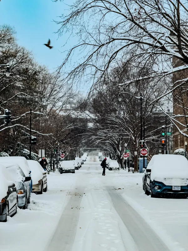
Washington is moving into a pronounced warming trend that is expected to accelerate melting of the region’s lingering snow and ice, even as forecasters continue to monitor the potential for a wintry mix during the upcoming weekend.
After a stretch of unusually harsh winter weather that brought subfreezing days, strong winds, and scattered snow showers, temperatures are forecast to rebound quickly during the workweek. The shift is expected to change roadway and sidewalk conditions from persistent packed snow and ice to slush, runoff, and refreezing risks during overnight lows.
What the current forecast shows for the District
The latest seven-day outlook for Washington indicates a climb from near-freezing highs early in the week to milder readings by midweek, followed by temperatures that remain seasonably cold but generally above the levels experienced during the recent Arctic outbreak. Daytime highs are forecast to reach the mid-40s on Tuesday, followed by highs in the 40s midweek and upper 30s to low 40s late week. Overnight lows are expected to dip below freezing on several nights, a setup that can re-freeze meltwater on untreated surfaces.
By the weekend, the forecast turns more unsettled. Current projections indicate the potential for precipitation late Sunday that may begin as a mix of rain and snow before changing to rain, depending on near-surface temperatures and timing.
Why melting can create new hazards
Rapid warming after prolonged cold often produces a layered set of impacts: snowbanks and compacted snow soften, drainage systems take on higher runoff, and water can pool in low spots. When nighttime temperatures fall back below 32°F, that meltwater can re-freeze into thin, hard-to-detect ice, particularly on bridges, shaded sidewalks, and secondary roads.
Forecasters are watching the weekend period for a temperature profile that could support mixed precipitation at the onset, before warmer air aloft or at the surface changes precipitation to rain.
Key variables for a potential weekend wintry mix
Surface temperatures: A degree or two near freezing can determine whether precipitation falls as rain, sleet, or wet snow at the start.
Timing: Overnight or early-morning precipitation increases the chance of freezing or icy spots, even with marginal temperatures.
Cold-air persistence: Residual cold near the ground can linger in sheltered locations and north-facing areas despite broader warming.
Ground conditions: Existing snowpack and icy surfaces can keep near-ground air cooler and prolong slick conditions.
What to watch through the week
As the warming trend continues, residents should expect changing conditions from day to day, including daytime thawing and nighttime refreezing. The weekend precipitation outlook remains conditional, with confidence expected to improve as the event gets closer and higher-resolution guidance clarifies precipitation type and timing.