Snow Slush and Gusty Winds: D.C. Braces for a Chilly Monday Commute
Morning: Snow Flurries and Commute Hazards
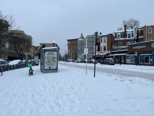
Washington D.C. residents are waking up to a wintry scene this Monday, February 23, 2026. Following a significant overnight storm, a Winter Weather Advisory remains in effect for the District until 10:00 AM. Early morning travelers should expect slippery road conditions and patches of slush, particularly on secondary streets and sidewalks. The National Weather Service reports that total snow accumulations from Sunday night into Monday morning have reached between 2 and 4 inches across the metropolitan area.
Temperatures during the morning hours will hover in the mid-to-upper 20s, with wind chills making it feel significantly colder. Spotty snow showers and light flurries are expected to continue through midday before tapering off. Mayor Muriel Bowser has activated a full deployment of the District Snow Team, with approximately 200 plows working to clear major roadways and bridges to ensure a safer morning commute.
Afternoon: Peak Winds and Chilly Conditions
As the snow showers subside in the afternoon, the primary weather story shifts to the wind. Clouds will continue to dominate the sky, keeping the environment gloomy despite the end of the precipitation. Temperatures are expected to climb to a daily high of approximately 41°F. However, the modest climb in temperature will be undercut by biting northwest winds that will persist throughout the day.
Sustained winds are projected to reach 15 to 20 mph, with frequent gusts as high as 35 mph throughout the afternoon hours. These gusty conditions may make outdoor activities uncomfortable and could lead to minor debris or downed branches. Residents are advised to secure loose outdoor furniture and remain cautious of wind-blown slush that may impact visibility for drivers.
Evening: Clearing Skies and Overnight Freeze
By the evening, the thick cloud cover will finally begin to break, leading to a gradually clearing sky. However, this lack of cloud insulation will cause temperatures to plummet quickly after sunset. The mercury is forecast to drop to an overnight low of approximately 24°F. As the sky clears, the wind will maintain its pace, keeping the wind chill values well below freezing.
Meteorologists warn that any remaining slush or standing water on roads will likely refreeze tonight, creating dangerous black ice conditions for Tuesday morning. A Cold Alert remains in effect for the city, and hypothermia shelters have been opened to provide safety for vulnerable populations. While a brief thaw is expected later in the week, winter remains firmly in control for the duration of Monday.
Monday Weather at a Glance
- High Temperature: 41°F
- Low Temperature: 24°F
- Wind Conditions: Northwest 15-20 mph, with gusts up to 35 mph
- Current Alerts: Winter Weather Advisory until 10:00 AM; Cold Alert in effect