Gray Skies and Morning Mist: A Mild Transition Friday in Washington
Morning: A Foggy Start for Commuters
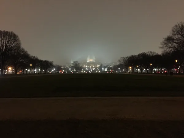
Washingtonians waking up this Friday, March 6, 2026, are greeted by a thick blanket of patchy to dense fog. Early morning visibility is significantly reduced across the District and the I-95 corridor, particularly near the National Mall and the Potomac River. Temperatures in the early hours are hovering in the mid-40s, creating a damp and chilly start to the day. Forecasters expect the most significant fog to dissipate by approximately 11:00 AM, though misty conditions may linger throughout the morning hours.
Afternoon: Clouds Linger as Temperatures Climb
As we move into the afternoon, the fog will give way to a mostly cloudy sky. While the sun may attempt to peek through on occasion, residents should expect gray conditions to dominate the landscape. High temperatures are predicted to reach between 55°F and 60°F, which remains mild for early March. A 'backdoor' cold front is currently influencing the region, keeping the District significantly cooler than areas further south, such as Roanoke, which is seeing temperatures climb into the 70s today.
Despite the heavy cloud cover, the afternoon is expected to remain largely dry for outdoor lunch plans, though the air will remain humid. Winds will stay light, coming from the east at approximately 5 to 10 mph.
Evening and Night: Isolated Showers and Damp Conditions
By Friday evening, the chance for isolated showers increases slightly. While widespread heavy rain is not anticipated, a few light sprinkles or a passing shower may necessitate an umbrella for those heading out to dinner in Adams Morgan or Georgetown. Overnight, the sky remains overcast with lows dropping back into the mid-40s. There is a slight potential for an isolated rumble of thunder late tonight as humidity levels remain high and a more significant weather system begins to approach from the west.
Weather Highlights and Weekend Outlook
- Temperature Range: A daytime high near 58°F and an overnight low of 45°F.
- Rainfall: Only isolated showers are expected today, with a 10% to 20% chance of precipitation.
- Wind: Steady east winds at 10 mph.
- Alerts: No active hazardous weather warnings are currently in effect, though commuters should remain cautious of low visibility during the morning hours.
Looking ahead, today serves as a transition point. While today is gray and damp, a major spring-like surge is expected this weekend. Washington residents can look forward to much warmer temperatures reaching the upper 60s and even the 70s by Saturday afternoon as the sun finally makes a return.
State tax refund delays possible in New York, Oregon, Idaho, South Carolina, and Washington, D.C., in 2026
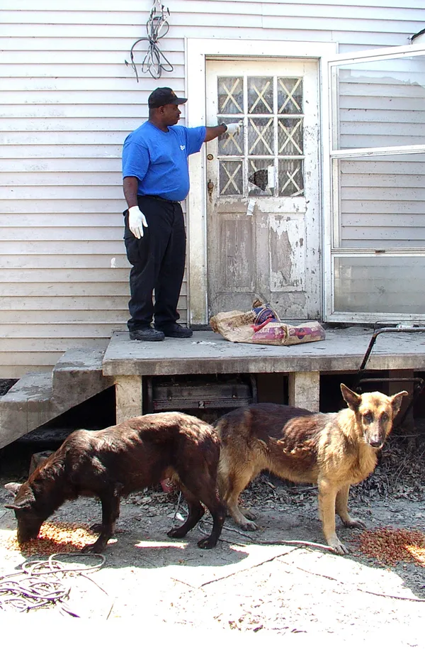
Ten emaciated dogs rescued from severe neglect in Southeast Washington apartment after two were found dead