Frosty Start, Golden Finish: D.C. Navigates a Bitterly Cold Tuesday
A Morning of Shivers and Shades
Washingtonians waking up this Tuesday, February 24, 2026, are being greeted by the coldest temperatures of the week. With mercury levels dipping into the mid-20s and low 30s across the District, the primary concern for early commuters is the biting wind chill. Morning wind chills are reported between 7 and 17 degrees, particularly in the downtown areas and suburbs to the north and west. Strong northwest winds averaging 18 to 19 mph, with periodic gusts reaching as high as 35 mph, are making the outside air feel significantly harsher than the thermometer suggests.
In addition to the biting cold, local meteorologists have issued warnings regarding black ice. Following the minor precipitation from the previous day, any damp spots on the roads or sidewalks have likely frozen solid overnight. If a surface looks wet this morning, officials recommend treating it as ice. Pedestrians and drivers should exercise extreme caution on untreated surfaces, bridges, and overpasses during the morning rush.
Clear Skies and Crisp Afternoon Highs
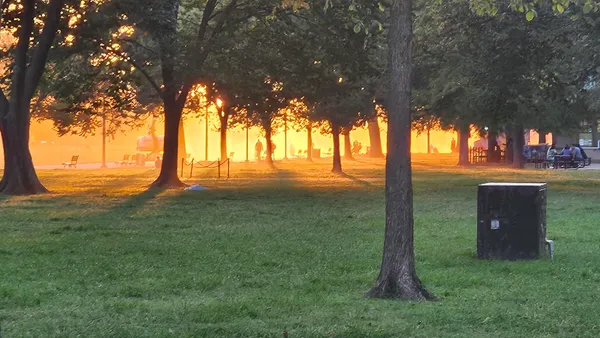
As the city moves into the midday hours, the heavy cloud cover from earlier in the week has dispersed, leaving behind bright, sun-drenched skies. While the sun is a welcome sight, it will provide little relief from the winter chill. Afternoon high temperatures are expected to peak between 36 and 41 degrees—well below the seasonal average for late February. Despite the low temperatures, the 'shades needed' forecast remains in effect through sunset; the low winter sun combined with clear skies will create significant glare for those traveling on east-west routes.
- Morning (7 AM - 11 AM): Temps in the upper 20s to low 30s. Clear and very breezy with gusts up to 35 mph.
- Afternoon (12 PM - 4 PM): Highs reaching 38-40°F. Full sunshine with winds slowly easing to 15 mph.
- Late Afternoon (4 PM - 6 PM): Temperatures dropping back toward the mid-30s. Clouds begin to filter in from the north.
Clouds Return for the Evening Commute
The pristine conditions will begin to shift as we head into the evening hours. Cloud cover is expected to increase rapidly after 6:00 PM as a weak system passes well to the north of the region. Temperatures will settle into the low 30s and remain relatively stable overnight. While the District will miss the brunt of any significant weather, there is a 20% chance of a stray rain or snow shower late tonight and into the early hours of Wednesday morning. No accumulation is expected from these flurries.
Looking ahead, the week remains a weather rollercoaster. Residents can look forward to a much milder Wednesday with highs returning to the 50s before another round of rain arrives on Thursday. For today, the best advice for D.C. residents is to layer up, wear a wind-resistant coat, and keep those sunglasses within reach.