Foggy Commute Precedes a Mild Afternoon Clearing Across the District
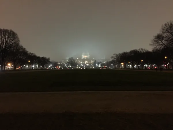
Damp Start and Dense Fog Impact Morning Commute
Washington D.C. residents waking up this Friday, February 20, 2026, are facing a gray and soggy start to the day. The National Weather Service and local meteorological reports indicate that the morning hours will be dominated by a combination of persistent rain showers and patchy dense fog. Drivers and commuters using the Beltway or public transit should exercise caution, as visibility is expected to be significantly reduced during the early morning rush hour. Temperatures at sunrise are hovering in the low to mid-40s, making for a damp and chilly start to the conclusion of the work week.
Afternoon Outlook: A Notable Warm-Up
There is good news for those planning to head out for lunch or evening activities. The morning precipitation is expected to diminish by early afternoon as a localized system moves toward the coast. Forecasts suggest a clearing trend starting around 1:00 PM, with skies transitioning from overcast to partly cloudy. This clearing will allow temperatures to climb much higher than earlier in the week, with an expected afternoon high reaching between 57°F and 59°F. This mild peak is nearly ten degrees above the historical average for late February in the District, providing a brief but welcome respite from the winter chill.
Evening Conditions and Rainfall Totals
As the sun sets, the District will remain relatively mild before a gradual cooling trend begins overnight. Evening temperatures are projected to settle back into the mid-45s. While the earlier rain will have cleared, the humidity will remain high, and some lingering mist may persist in low-lying areas near the Potomac. Total rainfall for today is expected to range between 0.10 and 0.25 inches, which is not enough to trigger flooding concerns but sufficient to keep the ground saturated through the evening hours.
Weekend Preview and Weather Alerts
While no severe weather warnings or wind advisories are currently in effect for the immediate D.C. metro area, the National Weather Service has issued notices regarding the patchy dense fog. Looking ahead, Saturday appears to be the pick of the weekend with highs near 54°F and clearer skies. However, the mild weather may be short-lived, as meteorologists are already tracking a potential winter storm system developing for Sunday into Monday, which could bring a mix of rain and snow back to the capital.
- Morning: Rain and patchy fog, 42°F.
- Afternoon: Clearing skies, high of 59°F.
- Evening: Partly cloudy and cooling, 45°F.
- Rainfall: Approximately 0.2 inches expected.