Bundle Up, D.C.: Brutal Morning Chill to Give Way to a Cloudy Afternoon Thaw
The Deep Freeze Grips the Capital
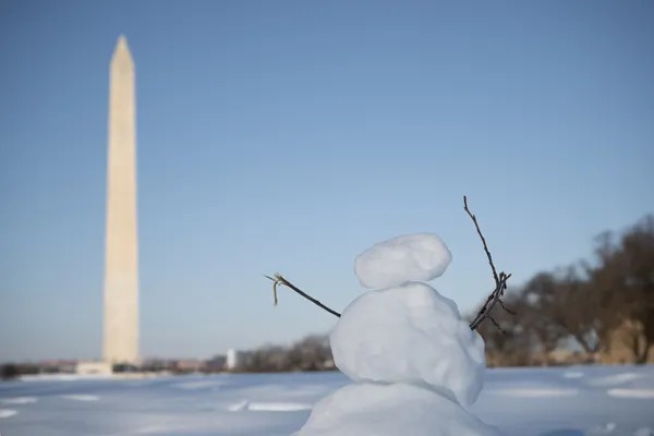
Washington D.C. is waking up to some of the most punishing winter conditions of the season this Monday, February 9, 2026. The National Weather Service has issued a Cold Weather Advisory for the greater D.C. region, remaining in effect until 10:00 AM. Residents should prepare for a day defined by a bitter start followed by a very slow recovery as the city attempts to break out of a prolonged Arctic stretch.
Morning: Dangerous Chills and Clear Skies
The morning hours will be the most hazardous for commuters and those spending time outdoors. Temperatures at sunrise are expected to hover between 5°F and 14°F. However, the true story is the wind chill; a combination of lingering northwest winds and extreme cold will produce feels-like temperatures between 5°F and -5°F. Authorities are warning of the risk of hypothermia for those not properly dressed. Expect clear, sunny skies through the early morning, though the bright sun will provide little in the way of actual warmth.
Afternoon: Breaking the Freezing Mark
By the afternoon, the District will finally see some relief from the sub-freezing grip. High temperatures are forecasted to reach approximately 33°F to 34°F, marking the first time in several days that the mercury has climbed above the freezing point. While the air will remain crisp, the biting winds from the weekend are expected to taper off significantly, shifting to a lighter breeze. As the day progresses, the clear morning skies will give way to increasing cloud cover, turning the afternoon overcast as a new system approaches the region.
Evening and Overnight Outlook
As the sun sets, temperatures will quickly retreat into the mid-20s, with an expected evening low around 24°F by 6:00 PM. The sky will remain overcast throughout the night, which may actually help trap some of the daytime warmth and prevent temperatures from plummeting back into the single digits. No precipitation is expected today, providing a dry but cold environment for the Monday evening commute.
Safety Alerts and Energy Notices
In addition to the local weather advisory, the PJM Interconnection has maintained a Cold Weather Alert for the District through the end of today to ensure the stability of the power grid during high heating demand. Local officials recommend the following precautions:
- Wear multiple layers of loose-fitting, warm clothing, including hats and gloves.
- Check on elderly neighbors and family members to ensure their heating systems are functioning.
- Bring pets indoors and ensure outdoor animals have access to unfrozen water.
- Ensure portable heaters are used safely and kept away from flammable materials.
While today marks the beginning of a slight warming trend, with temperatures expected to reach the 40s later this week, the immediate focus remains on navigating the frigid conditions of this Monday morning.