Biting Winds and Bright Skies: Arctic Air Takes Hold of the District
Morning: A Frigid and Clear Start
Washingtonians waking up this Thursday, February 5, 2026, will be met with the coldest air of the season so far. The day begins with remarkably clear skies, but the sunshine offers little warmth as an Arctic blast settles over the region. Early morning temperatures have plummeted to a low of 19°F, though current observations indicate it feels significantly colder. With humidity hovering around 68% and a steady breeze, the wind chill factor has pushed the 'feels like' temperature down to a biting 10°F. Commuters are advised to layer up heavily, as exposed skin will feel the sting of the frost immediately upon stepping outside.
Afternoon: Sunny but Deceptive
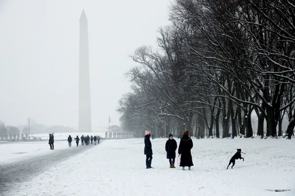
As we move into the afternoon, the District will remain under mostly sunny skies, providing a bright backdrop for the city’s monuments. However, do not let the clear blue canopy fool you. Daytime highs are expected to peak at a modest 34°F, remaining just barely above the freezing mark. The real story of the afternoon is the wind. Strong gusts from the northwest are projected to range between 10 and 20 mph, with occasional bursts exceeding 25 mph. These persistent winds will keep the effective temperature in the low-to-mid 20s throughout the peak of the day. For those planning a walk through the National Mall or heading out for a midday lunch, a wind-resistant coat and gloves are essential gear.
Evening and Overnight: The Chill Deepens
Conditions will begin to shift as the sun sets. The evening will see a transition from clear to partly cloudy skies as a weak clipper system approaches from the north. Temperatures will drop quickly back into the 20s by 7:00 PM, eventually bottoming out in the upper teens overnight. While the day remains dry, there is a lingering 10% chance of a stray snow flurry late tonight, though no accumulation is expected in the immediate metro area. Winds will taper slightly to 5-15 mph, but the lack of solar heating will make the overnight hours feel exceptionally sharp.
Wind and Safety Advisories
A Cold Weather Advisory is currently in effect for the District of Columbia. Health officials and meteorologists are urging residents to take precautions against hypothermia and frostbite, particularly for those who must spend extended periods outdoors. Additionally, the District Snow Team remains on alert; while significant precipitation is not expected today, the prolonged sub-freezing temperatures mean that any moisture on the roadways from earlier in the week could result in stubborn icy patches. Looking ahead, this Arctic air is expected to linger, with even colder temperatures and a higher chance of snow flurries forecasted for the upcoming weekend.