A Polar Punch for the District: Subzero Wind Chills and Flurries Ahead
The Deep Freeze Settles In
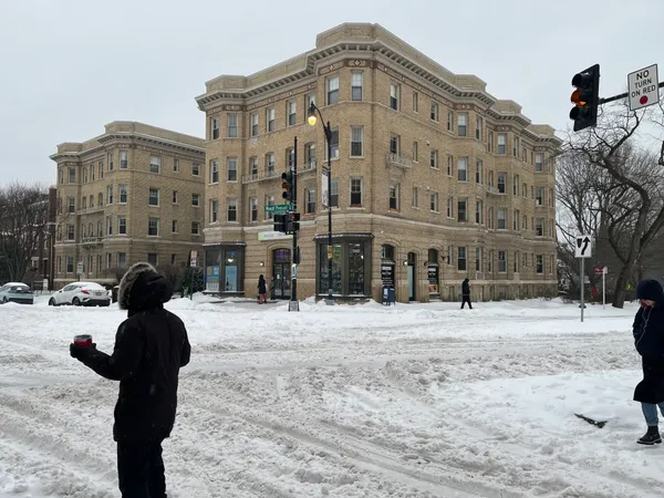
Washington D.C. is waking up to some of the most punishing winter conditions of the season this Wednesday, January 28, 2026. A Cold Weather Advisory remains in effect for the entire metropolitan area as a legitimate Arctic air mass firmly establishes its grip on the region. Residents should prepare for a day where temperatures struggle to climb and wind chills remain dangerously low.
Morning: Bitter Cold and Subzero Chills
The morning hours are particularly brutal, with actual thermometer readings starting in the single digits and low teens. However, persistent northwesterly winds are making it feel significantly colder. Wind chill values are expected to hover between -5 and -15 degrees throughout the morning commute. The National Weather Service has warned that these conditions can lead to frostbite on exposed skin in as little as 30 minutes, making heavy layering and face protection essential for anyone heading outdoors early.
Afternoon: Sunny Skies, Frigid Reality
Despite a mix of sun and clouds expected during the middle of the day, there will be little relief from the cold. Afternoon highs are projected to peak only in the low to mid-20s, well below the freezing mark. While the sun may offer a deceptive brightness, the northwesterly winds will continue to gust between 10 and 25 mph, keeping the "RealFeel" temperatures in the low teens at best. It is a day to limit outdoor activities and ensure that pets are kept strictly indoors.
Evening and Overnight: Flurries and Increasing Clouds
As we head into the evening, cloud cover is expected to increase across the District. Meteorologists are tracking a weak disturbance that could bring a few stray snow flurries or light flakes to the area after sunset. While no significant accumulation is expected from these evening flurries, they serve as a reminder of the volatile winter pattern currently in place. Overnight lows will once again plummet into the single digits to low teens under partly cloudy skies.
Looking Ahead: Monitoring a Weekend Storm
City officials and weather experts are already looking beyond today’s deep freeze. While the immediate concern is the extreme cold, there is growing uncertainty regarding a potential coastal storm or nor'easter developing this weekend. Current models suggest the possibility of significant snow or ice by late Saturday, though the exact track remains to be seen. For today, the priority remains safety in the face of record-challenging cold. Stay warm, check on vulnerable neighbors, and keep an eye on the latest alerts as the weekend approaches.